Large selection of products and fast shipping guaranteed with Canpar and UPS services!
- MEN
- WOMEN
- FOOTWEAR
- BACKPACKS
- CLIMB
- HIKE
- ICE CLIMBING
- SKI
- BOOKS + MAPS
- OTHER
- SALE
- Gift cards
- BLOG
Your cart is currently empty
Product image slideshow Items
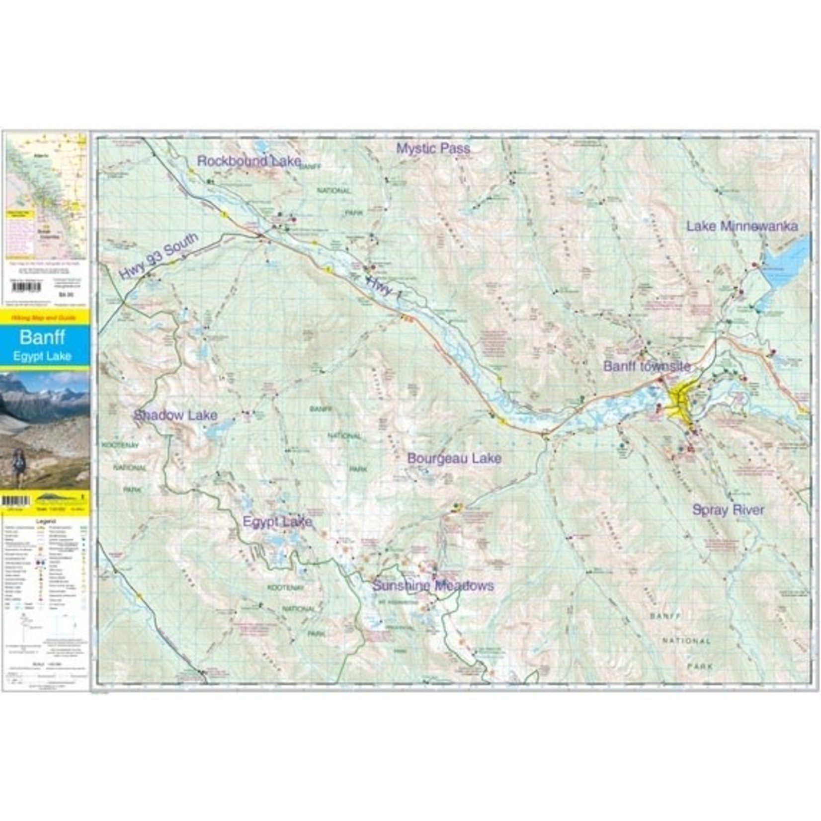
This map is particularly useful for hikers heading into the Sunshine Meadows and Egypt Lake regions of Banff National Park or if you are headed into Shadow Lake area.
Available in store
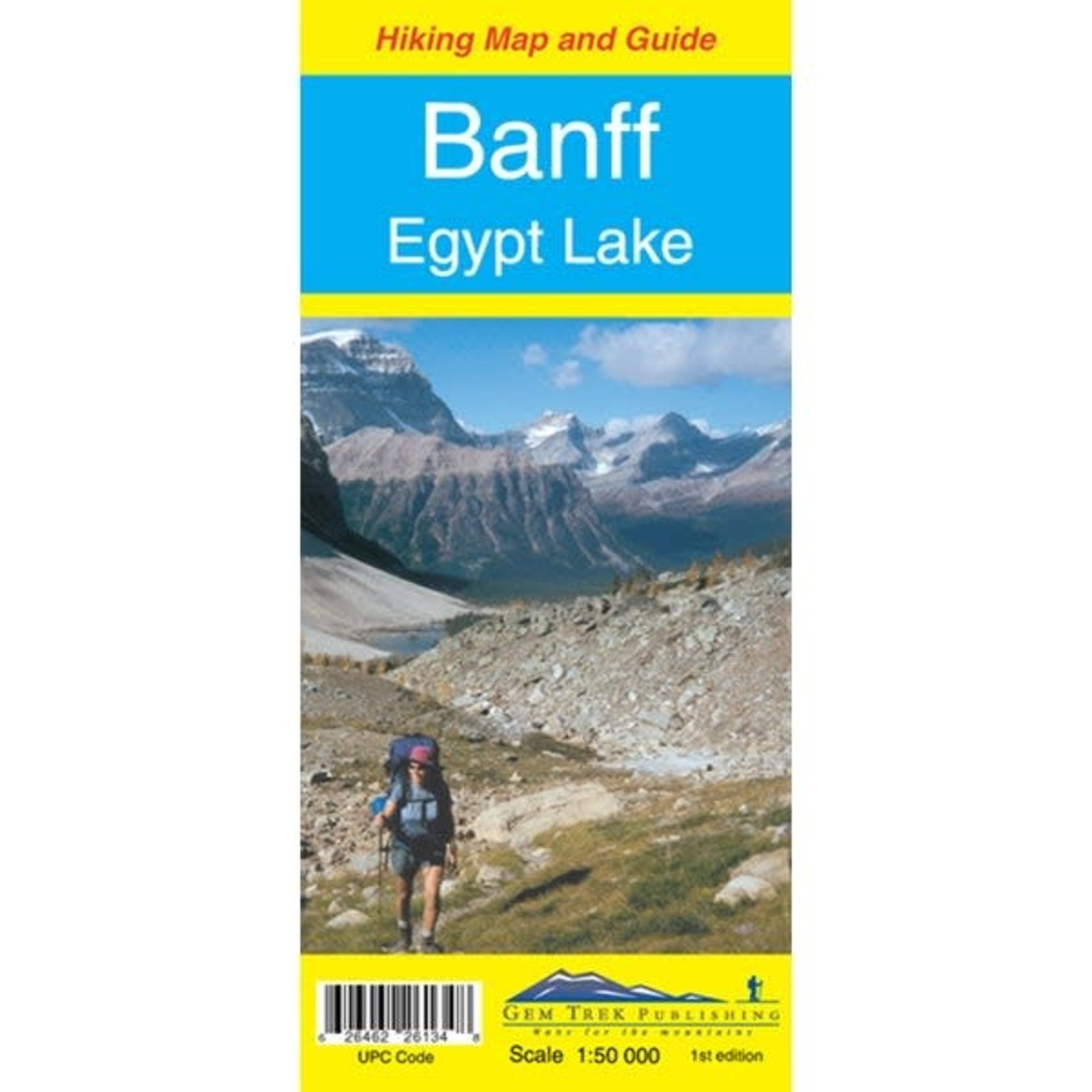
CloseGem Trek's Banff-Egypt Lake Map covers the most popular hiking trails in the immediate area of the town of Banff and immediately to the north and west.
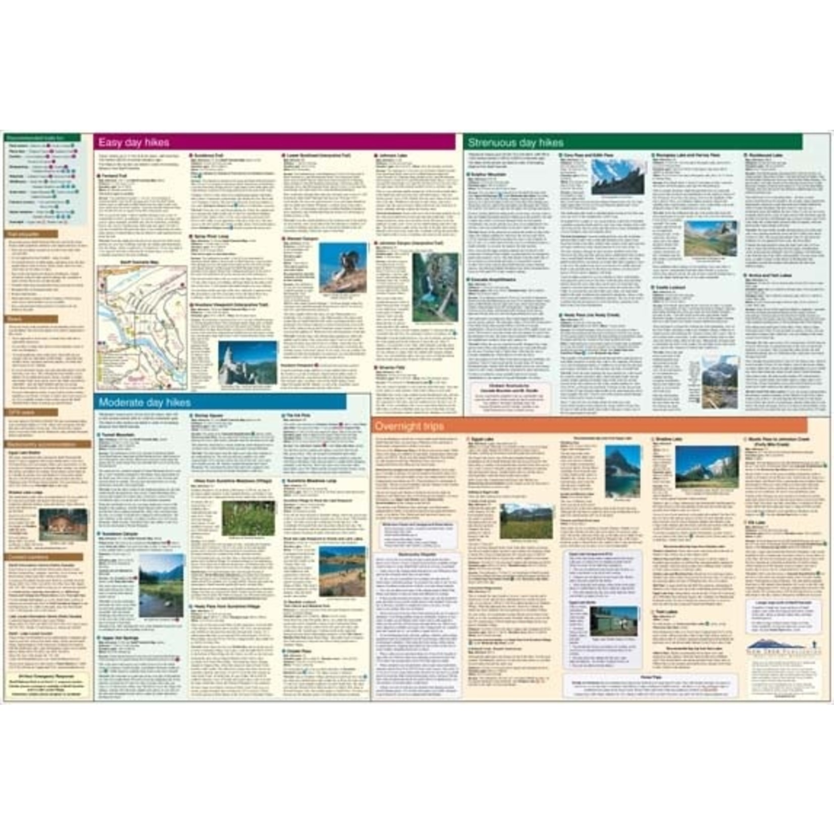
The Banff-Egypt Lake Map features detailed cartography, accurate hiking trails with distances, and details such as side trips and backcountry campgrounds. For road travellers, it includes viewpoints, picnic areas, and campgrounds. On the back of the map are trail descriptions of 17 recommended day hikes and four classic multi-day trips, all referenced to the map on the front. Also on the back is a list of trails recommended for early season, birdwatching, wildflowers, waterfalls, expansive views, awe-inspiring scenery, alpine meadows and rainy days. Included are contact numbers for visitor centres and backcountry bookings, plus information on Egypt Lake Shelter and Shadow Lake Lodge.
The Banff Egypt Lake Map stretches from just east of Taylor Lake in the west to the west end of Lake Minnewanka in the east, and from Mystic Pass and Rockbound Lake in the north to Citadel Pass and Vermilion Crossing (Kootenay National Park) in the south. This map is particularly useful for hikers heading into the Sunshine Meadows and Egypt Lake regions of Banff National Park. All of the great day hikes in and around the town of Banff are covered on this map, including Tunnel Mountain, Sundance Canyon, Spray River Loop, and Sulphur Mountain. A little further from town, you’ll find the classic trails to Cory Pass, Bourgeau Lake and the fabulous alpine meadows at Harvey Pass, plus Stoney Squaw, C-Level Cirque, Cascade Amphitheatre, Elk Lake, Mystic Lake, Castle Lookout, Rockbound Lake, Johnston Canyon and the Ink Pots. Sunshine Meadows detail includes trails to Citadel Pass, Rock Isle Lake, the Grizzly-Larix Lakes Loop, Twin Cairns-Meadow Park, and Simpson Pass.
If you are headed into the Egypt Lake or Shadow Lake areas, this is the map you will want. All of the access routes in and out of these two popular backcountry areas are shown in great detail, including Redearth Creek, Healy Creek, Arnica Lake, Twin Lakes, Hawk Creek-Ball Pass, as well as the route to Egypt Lake over Wawa Ridge and Simpson Pass from Sunshine Village. An inset map on the back increases coverage of the town of Banff.
The Banff-Egypt Lake Map includes:
- relief shading to better show the topography
- full colour on both sides
- hydrology including rivers, rapids, glaciers, and waterfalls
- mountain names and all available mountain elevations
- all campgrounds including backcountry campsites
- points of interest and attractions as well as picnic areas and highway viewpoints
Product carousel items


